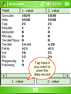
Deletes the boundary line between two polygons and create a new polygon. Once you selected the boundary line between the polygons DigiTerra Explorer opens the Area join panel to select which attribute data record you want to store to the new polygon. Please, note that all geometry based data field will be recalculated in the new polygon's data record. The boundary line can be selected when the identify button turned on for the edited layer in the Layers panel.
Tap / Left click: selects boundary line.
Drag: selects boundary line (drags selection point) on the map with displayed crosshairs.
The Polygon Join remains active until another tool is activated.
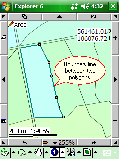
Boundary line between two polygons
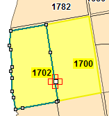
In the Desktop version the neighboring polygons filled with yellow colour and the edited source layer is labeled by the first data field to help you identify the polygon's data in the Area join dialog.
Area joining in the Desktop version
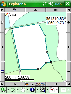
Joined new polygon
![]() The Polygon Delineation and the Polygon Join can be stored when editing is turned on for the edited polygon layer in the Layers panel. If the attribute table contains data fields with geometry related default value, the cell value of current data field will be updated after you have applied the Polygon Delineation or the Polygon Join tool.
The Polygon Delineation and the Polygon Join can be stored when editing is turned on for the edited polygon layer in the Layers panel. If the attribute table contains data fields with geometry related default value, the cell value of current data field will be updated after you have applied the Polygon Delineation or the Polygon Join tool.
![]() The last topological edit operation can be undo by using the
The last topological edit operation can be undo by using the ![]() Undo tool that you made to a feature with the Polygon Join tool.
Undo tool that you made to a feature with the Polygon Join tool.