You can print the map view to printer/plotter or file through the Print Setup and the Print Map panel. You can access to this desktop command in the menu bar: File > ![]() Print and in the toolbar:
Print and in the toolbar: ![]() as well.
as well.
The Print Map panel
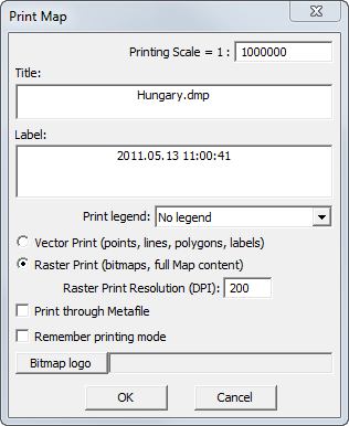
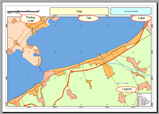
Printing scale = 1: Enter the value of the Printing Scale to the printable map view. You can see what will be printed in real-time on the map view as you entered a different Printing Scale value. The printable area marked with blue boundary on the map view. Default is Printing Scale is 1: 10 000.
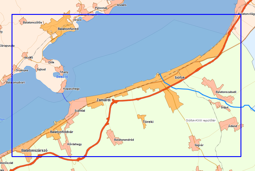
![]() You can adjust the what will be inside the printable area (blue boundary on the map view) by entering the Printing Scale and by using the Pan tool in the View menu/toolbar.
You can adjust the what will be inside the printable area (blue boundary on the map view) by entering the Printing Scale and by using the Pan tool in the View menu/toolbar.
Boundary of the printable area on the map view
Title: Customizable textual field that will be placed on the printed map as Map Title. Default Title is the name of the mapping project.
Label: Customizable textual field that will be placed on the printed map as Map Label. Default Label is the current system date.
Print legend: Optionally printable legend of the thematic classes. You can customize the contents of the map legend in the Classes/Class panel and by using the Identify option (on/off) in the Layers panel. Default is No legend.
●No legend: Map legend won't be placed on the printed map.
●Legend ad Top-Left: Map legend will be placed in the top-left corner on the printed map.
●Legend ad Top-Right: Map legend will be placed in the top-right corner on the printed map.
●Legend ad Bottom-Left: Map legend will be placed in the bottom-left corner on the printed map.
●Legend ad Bottom-Right: Map legend will be placed in the bottom-right corner on the printed map.
Printed map
Vector Print: (points, lines, polygons, labels): Uses the Windows graphics device interface (GDI) at the printing. When you want to print only vector layers/symbols Vector Print mode is recommended to use. Raster layers, raster symbols, transparency cannot be printed in this printing mode. Default is Vector Print mode.
Raster Print: (bitmaps, full Map content): When you want to print the full content of the map view (including raster/vector layers and raster symbols) Raster Print mode is recommended to use.
Raster Print Resolution (DPI): You can customize the resolution of the printable map depending on print quality. Default is 200 dpi.
Print through Metafile: Prints through Metafile. This option is recommended to use for some special older printers.
Remember printing mode: Saves and reloads the last selected vector or raster printing mode.
Bitmap logo: You can add a bitmap logo in these formats to your printable map: BMP, PCX, JPG, TIF
OK - Sends the printable content to the selected Printer.