Polygon Delineation |
  
|
Polygon Delineation |
|
Separates one or more polygon features into separated polygons based on an overlapped polyline (auxiliary line) into the same edited layer. The corresponding segments of the auxiliary line will be the boundary between the created new polygons.
Tap / Left click: adds vertices of the auxiliary line on the map.
Drag: adds vertices of the auxiliary line on the map with displayed crosshairs.
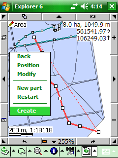
Tap and hold / Right click: displays the editing context menu. The Polygon Delineation can be stored by selecting the Create option from the editing context menu.
The Polygon Delineation remains active until another tool is activated.
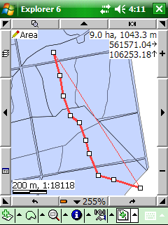
Overlapped auxiliary line through to polygons
Selected Create option in editing context menu to store new polygons
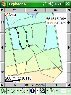
Results of the Polygon Delineation
![]() The last topological edit operation can be undo by using the
The last topological edit operation can be undo by using the ![]() Undo tool that you made to a feature with the Polygon Delineation tool.
Undo tool that you made to a feature with the Polygon Delineation tool.