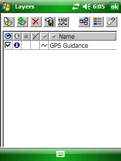
You can define a GPS guidance layer with parallel lines above an area for GPS guidance. The GPS Guidance tool remains active for (re)defining a new GPS guidance layer until another tool is activated. Please note that the GPS Guidance layer does not stored to the opened project automatically it is an auxiliary layer only.
Tap / Left click: adds vertex of the start and the end point of the baseline on the map at the tapped location then opens the GPS Guidance panel.
Drag: adds vertex of the baseline on the map at the tapped location with displayed crosshairs.
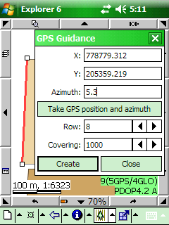
Defined baseline and the displayed GPS Guidance panel
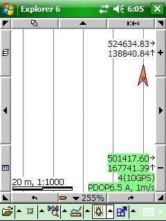
Parallel guidance lines on the map view and the GPS Guidance layer in the Layers panel
X: Easting coordinate of the baseline's first placed vertex.
Y: Northing coordinate of the baseline's first placed vertex.
Azimuth: Direction of the baseline. 0 angle is upwards, positive direction is clockwise.
Take GPS position and azimuth - Takes over the calculated GPS heading and the current GPS position to the X, Y and Azimuth values.
Row: Distance between parallel guidance lines.
Covering: Covered area by parallel guidance lines in four direction.
Create: Stores the parallel guidance lines in the GPS guidance line feature layer. The GPS guidance layer can be arbitrarily redefined to a new baseline.
|
Basic |
Advanced |
Professional |
Availability of the "GPS Guidance" tool in different editions |
|
|
|